

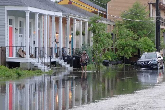
Hurricane Isaias made landfall in North Carolina but still flooded streets, damaged businesses, and cut power to hundreds of thousands across the Carolinas.
Story Highlights
- Storm surge flooded coastal towns and damaged piers and shops in the Carolinas.
- Officials logged road closures from deep water and debris along popular beach routes.
- Counties reported tens of thousands of power outages, with some lasting days.
- Forecasts warned of surge and heavy rain that matched many observed impacts.
What Officials Confirmed Happened Along the Coast
National Weather Service offices reported storm surge that pushed water into coastal neighborhoods in South and North Carolina on August 3 and 4, 2020. Water destroyed part of the Sea Cabin Pier and damaged waterfront shops in Southport. Towns saw bulkhead erosion, street flooding, and debris washed inland. Local officials also reported widespread power cuts as lines fell and equipment failed in the wind and water. These are official post-storm observations, not early forecasts.
County reports in the Wilmington service area recorded significant outages. Brunswick County had about 53,000 customers without power. New Hanover County had about 85,000 without service. Pender County had about 27,500 out. Crews needed several days to restore power in some neighborhoods as access was limited by downed trees and high water. These numbers place the event among the more disruptive storms for the area in recent years, though impacts varied by location.
Roads, Vehicles, and Local Damage Totals
Storm surge and waves covered roads that run next to the beach. Officials recorded 12 to 18 inches of water on South Carolina Highway 9 and closed Main Street and Ocean Boulevard because of flooding. Water covered parts of Myrtle Beach, Garden City, and North Myrtle Beach. On Oak Island, surge damaged or destroyed an estimated 75 to 100 vehicles. Southport’s waterfront shops took on water, and town leaders estimated about $40 million in damage based on early assessments.
South Carolina’s state climatology office documented more than three inches of rain in parts of Georgetown and Horry counties. A water level gauge at Springmaid Pier reached 10.18 feet, confirming the surge that pushed onto roads and into yards. Crews later found sand and debris covering roads on Pawleys Island. These records provide an independent state-level view that aligns with the federal weather reports and local observations in coastal communities.
Wind, Tornadoes, and Why the Impacts Varied
Weather records show six confirmed tornado touchdowns in the Wilmington service area during the event. Wind gusts topped 70 miles per hour in some spots, which was strong enough to topple trees and damage roofs. The strongest impacts tracked near the coast and along the storm’s path inland. Areas a short distance away saw far less rain and lower surge. That is common with fast-moving tropical systems that push local spikes in wind and water rather than uniform damage.
Take a look at the damage left behind in Pensacola Beach, Florida, as Hurricane Isaias moves through the Southeast.
🎥 Courtesy: CNN Newsource, ACCUWEATHER pic.twitter.com/PBOuuUxDPy
— FOX Baltimore (@FOXBaltimore) October 10, 2026
Before landfall, the National Hurricane Center warned that the mix of storm surge and tide could flood normally dry areas and that three to six inches of rain could fall, with higher totals in places. Those alerts matched many of the actual outcomes along the North and South Carolina coasts once Isaias came ashore. Forecasts must highlight worst-case but plausible risks to save lives, and in this case, much of what was warned did occur in the hardest-hit zones.
Why This Matters Beyond the Coast
Families and small businesses along the shore again faced a familiar pattern: sudden floodwater, power loss, and cleanup costs that strain savings and insurance. Residents on both the right and the left see how storms can expose weak infrastructure and slow recovery systems. People expect government at every level to clear roads fast, restore power quickly, and harden the grid. Official reports from Isaias show both progress and gaps, and they underline the need for honest, local detail, not broad labels.
Sources:
facebook.com, newsroom.fpl.com, nhc.noaa.gov